Go to home page The 150-Foot Solar Tower
Maps to Mt. Wilson Observatory


Click for maximum image size

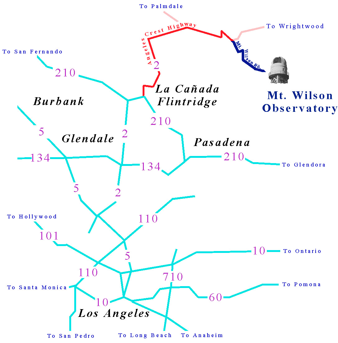
The distance from La Cañada - Flintridge to the Angeles Crest / Mt. Wilson Road junction is approximately 15 miles.
The distance from the Angeles Crest / Mt. Wilson road junction to the Observatory is approximately 5 miles.
Total driving time from the 210 freeway to the front gate of Mt. Wilson Observatory is usually about 30-35 minutes.

Other Mt. Wilson map resources:
Google Maps (Road map)
MSN (Road map)
Topozone (Topo map)
Lizzie's Trail Inn (1920's hiking map)
Terraserver (Aerial Photo)

Return to 150-Foot Solar Tower Home Page


Page format last updated on May 16, 2006.
Page content and all images ©1998,2003 The Regents of the University of California. All rights reserved.